
Meet Mapflow Agent! 💬 Talk to it to run the workflows and interpret the results. 🚀
From Our Blog
Insights, updates, and stories from our team

May 8, 2026
MapflowAgent - Chat with Our Geospatial AI Engine
Introducing Mapflow Agent, an LLM-powered beta tool that transforms how users interact with geospatial processing. Simply describe what you need to map, and the Agent builds the right workflow and cost estimates instantly.

Apr 3, 2026
Geoalert Team gathering in Yerevan
Last week we met in Armenia to work, brainstorm, and spend time together as a distributed team. Here are practical takeaways from organizing an in-person gathering, plus how we used the week to accelerate AI adoption in our RnD workflow.
Mar 20, 2026
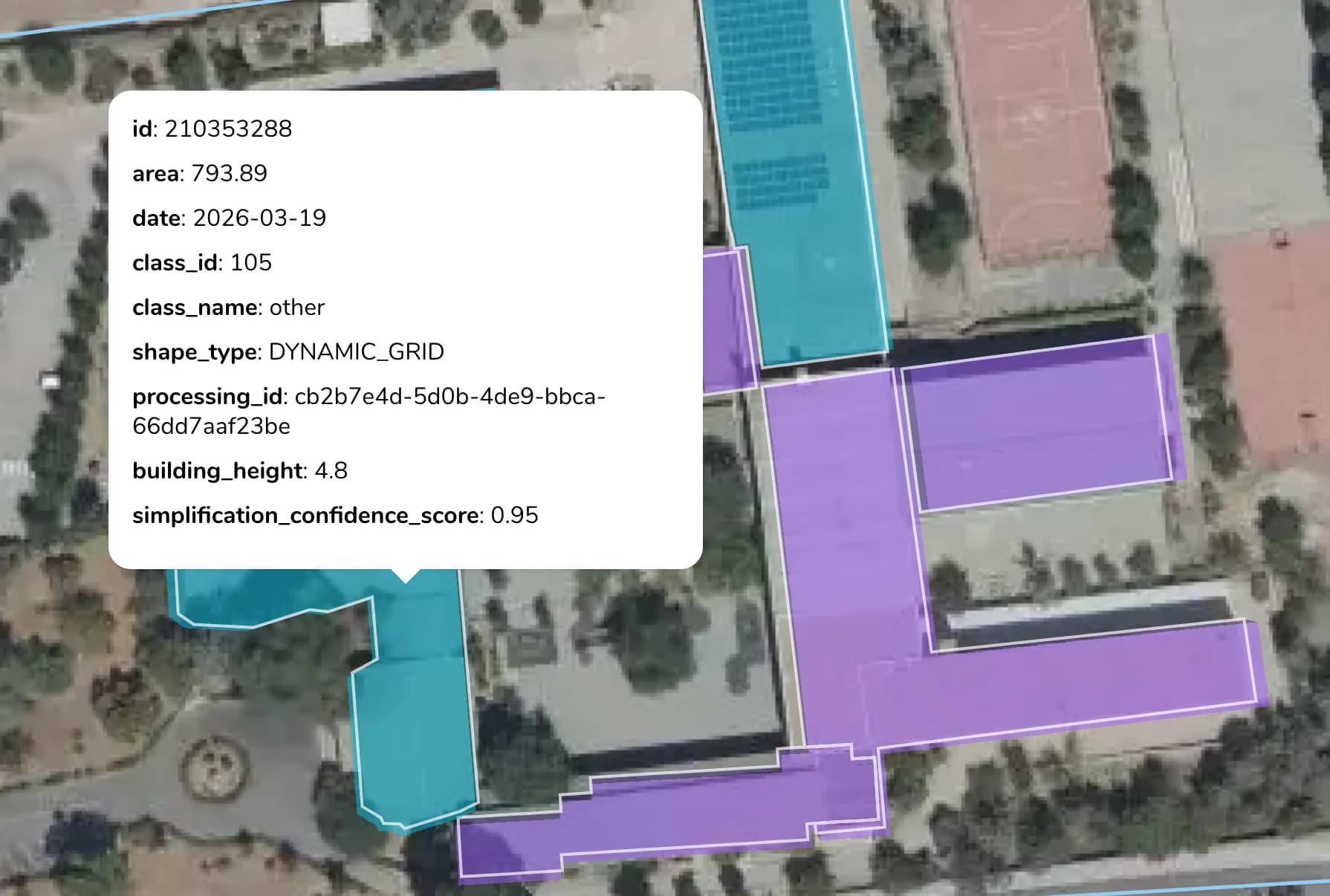
Building Simplification refinement and back to a single option
Based on user feedback, we refined building simplification and made it a single option again — adopted for different building geometries (rectilinear + curved) across different construction patterns. The simplification is enabled by default, making it cheaper for users.

Jan 16, 2026
Open buildings data in China - how good is it? Testing on our benchmark
The most significant open building dataset in 2025 (and possibly ever) is "GlobalBuildingAtlas". What's great about this dataset is that it outperforms all others in the number of buildings (2.75 billion) and, in our estimation, also outperforms them in data quality. We tested it on our benchmark over some China urban areas along with the Mapflow model.

Dec 10, 2025
Simplify it! Endless story about the automatic Building polygons
One recurring challenge in the Mapflow Building Footprints scenario is simplification. As soon as the model extracts the mask and vectorizes it, the job starts refining the geometry to "look good". Hmm… "look good". Sounds unclear, doesn't it?
Nov 14, 2025
Mapflow Imagery Search
🚀 We are launching a major update to Mapflow's satellite imagery search. Read more about why Mapflow Search is not yet another commercial imagery marketplace with carts and checkouts?

Dec 12, 2024
How we approached a foundational model and ended up with a detector...
Many problems in computer vision have been solved through a target-specific approach – sorting the target class pixels from all the rest. With the rise of foundational models, each pixel is meaningful and can be assigned to the target class just by prompting the model...

Sep 5, 2023
How to run bulk processing for feature extraction with Mapflow API
In case you have many areas of interest to process or update, it can be boring to upload them one by one using Web or GIS user tools. In this case, you'd better think about using Mapflow Processing API.

Jul 7, 2023
Segment Anything with Mapflow
While studying the META AI foundational model for image segmentation, we decided to try implementing it into the Mapflow platform and adjusting to the geospatial imagery processing workflows on a large scale.
Feb 26, 2023
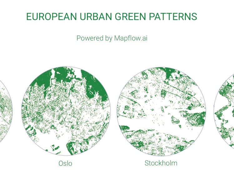
European Urban Green Patterns
By using Mapbox satellite basemap and Mapflow AI-Mapping Platform, 45 urban green patterns were generated. From Reykjavik to Valletta, from Dublin to Kyiv, the tree cover for each European capital reflects a unique mix of human-nature interaction.
Dec 16, 2022
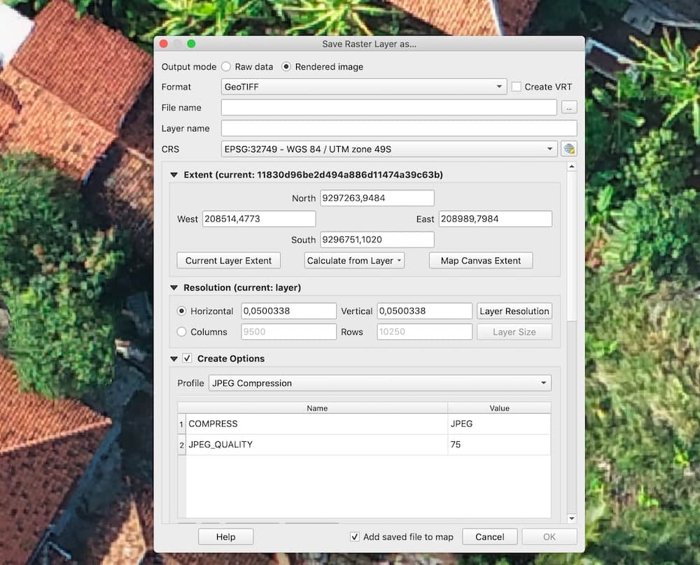
How to process your own UAV imagery with Mapflow
We started publishing userguides collecting useful tips on how to work with Geospatial imagery using #Mapflow and some of open source technologies. ❗️Tell us if you have more tips to share with the community or want to suggest other topics to shed the light on – we are ready to help.

Aug 31, 2022
Being a SaaS (Small Analytics company) in the Earth Observation market
The streaming services that can be integrated into third-party workflows and applications are definitely the new and trending business model. However, the reality is that the major part of this data is still distributed as files. Go on to catch the new fascinating opportunities…